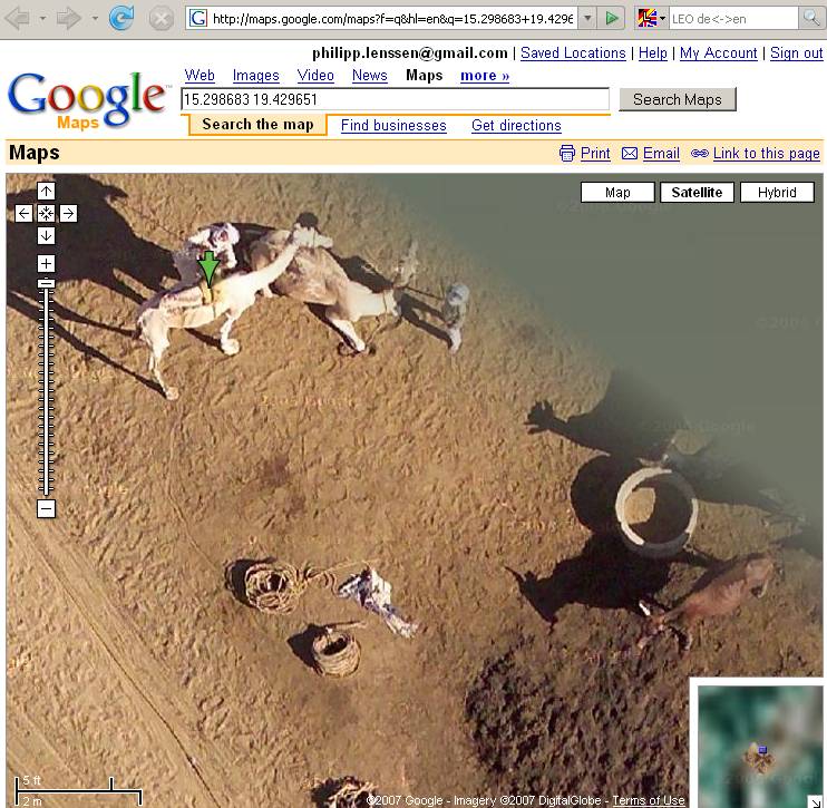
Well, this is quite cool and a tad scary. Google maps can zoom in a lot tighter than was originally thought. From Phillipp Jenssen’s blog (via Steve Rubel’s site.)

- Select a location and switch to satellite view
- Zoom in as far as you can, and click “link to this page†at the top right
- Now replace the “z†parameter in the URL with a higher value, e.g. 20, 22, or 23, and wait. Some locations will now show more detailed imagery
I tried this out in a few spots in DC and San Francisco. It works. Very cool stuff. But, from a privacy angle it presents some unsettling questions.
[tags]Google Zoom, Satellite Photos, Steve Rubel[/tags]


hey i’m trying this but it isn’t working for me. what can i do to try and get it?
@julie
Hmmm, try this link,
http://maps.google.com/maps?f=q&hl=en&q=15.298683+19.429651&layer=&ie=UTF8&z=23&ll=15.298684,19.429651&spn=0.001291,0.002698&t=k&om=1&iwloc=addr
cheers,
Dave
hello there !!!!!!!!!!!
i cant seem to be able to use this link what is wrong w